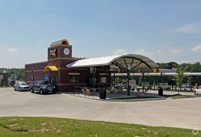
Property Record
4534 Brandt Pike, Dayton, OH 45424


NEARBY LISTINGS FOR SALE OR LEASE
Property Detail
4534 Brandt Pike
Dayton, OH
Villages Of Cloud Park 1-A
R72217303-0052
83229 VILLAGES OF CLOUD PARK 1-A
Carwash
Montgomery
X
Ohio
39113C0159E
83229
2024
1.36 AC
2025
Northeast Central Dayton
090304
Cincinnati/Dayton
4,644 SF
DEMOGRAPHICS near 4534 Brandt Pike
1 Mile
3 Mile
5 Mile
2024 Total Population
7,924
41,663
138,258
2029 Population
7,735
40,868
138,636
Pop Growth 2024-2029
(2.39%)
(1.91%)
+ 0.27%
Average Age
39
39
38
2024 Total Households
3,129
16,847
56,814
HH Growth 2024-2029
(2.36%)
(1.96%)
+ 0.32%
Median Household Inc
$71,040
$64,230
$52,850
Avg Household Size
2.50
2.40
2.30
2024 Avg HH Vehicles
2.00
2.00
2.00
Median Home Value
$154,818
$149,896
$133,695
Median Year Built
1970
1971
1969
Nearby Places
Map Layers
Map Styles
 Street
 Aerial
- Restaurants
- Banks
- Shops
- Fitness
- Groceries
PUBLIC TRANSPORTATION
AIRPORT
James M Cox Dayton International
DRIVE
WALK
Distance
James M Cox Dayton International
20 min
12.4 mi
Freight Ports
Port of Toledo
DRIVE
WALK
Distance
Port of Toledo
177 min
152.1 mi
SALE & LEASE HISTORY
LISTING DATE
SALE/LEASE

Sep 05, 2019
For Sale
Dec 22, 2020
For Sale
Nearby Properties
Address
Land Use
TOTAL SIZE
Lot Size
Zoning
Address
Land Use
TOTAL SIZE
Lot Size
Zoning
14.22 AC
Address
Land Use
TOTAL SIZE
Lot Size
Zoning
30.29 AC
Address
Land Use
TOTAL SIZE
Lot Size
Zoning
22,133 SF
47.58 AC
Address
Land Use
TOTAL SIZE
Lot Size
Zoning
144,340 SF
91.38 AC
Address
Land Use
TOTAL SIZE
Lot Size
Zoning
18,087 SF
19.69 AC
Address
Land Use
TOTAL SIZE
Lot Size
Zoning
51.78 AC
Address
Land Use
TOTAL SIZE
Lot Size
Zoning
22.70 AC
Address
Land Use
TOTAL SIZE
Lot Size
Zoning
1,080 SF
30 AC
Address
Land Use
TOTAL SIZE
Lot Size
Zoning
93,360 SF
694.57 AC
Address
Land Use
TOTAL SIZE
Lot Size
Zoning
21.53 AC
Address
Land Use
TOTAL SIZE
Lot Size
Zoning
10.25 AC
Address
Land Use
TOTAL SIZE
Lot Size
Zoning
13.47 AC
Address
Land Use
TOTAL SIZE
Lot Size
Zoning
67,094 SF
5.12 AC
Address
Land Use
TOTAL SIZE
Lot Size
Zoning
66,042 SF
9.47 AC
Address
Land Use
TOTAL SIZE
Lot Size
Zoning
2,034 SF
23.83 AC
Address
Land Use
TOTAL SIZE
Lot Size
Zoning
139,400 SF
20.26 AC
Address
Land Use
TOTAL SIZE
Lot Size
Zoning
7,800 SF
19.49 AC
Address
Land Use
TOTAL SIZE
Lot Size
Zoning
263,022 SF
19.33 AC
Address
Land Use
TOTAL SIZE
Lot Size
Zoning
11.30 AC
Address
Land Use
TOTAL SIZE
Lot Size
Zoning
97,859 SF
7.67 AC
Address
Land Use
TOTAL SIZE
Lot Size
Zoning
66,610 SF
3.90 AC
Address
Land Use
TOTAL SIZE
Lot Size
Zoning
52,409 SF
18.24 AC
Address
Land Use
TOTAL SIZE
Lot Size
Zoning
4,200 SF
326.38 AC
Address
Land Use
TOTAL SIZE
Lot Size
Zoning
3,510 SF
4 AC
Address
Land Use
TOTAL SIZE
Lot Size
Zoning
98,474 SF
4.57 AC
Address
Land Use
TOTAL SIZE
Lot Size
Zoning
9,198 SF
9.99 AC
Address
Land Use
TOTAL SIZE
Lot Size
Zoning
216,822 SF
11.42 AC
Address
Land Use
TOTAL SIZE
Lot Size
Zoning
15.19 AC
Address
Land Use
TOTAL SIZE
Lot Size
Zoning
21,798 SF
5.52 AC
Address
Land Use
TOTAL SIZE
Lot Size
Zoning
78,466 SF
8.01 AC
The World's #1 Commercial Real Estate Marketplace
Connect with us
© 2026 CoStar Group
The information above has been obtained from sources believed reliable. While we do not doubt its accuracy we have not verified it and make no guarantee, warranty or representation about it. It is your responsibility to independently confirm its accuracy and completeness. Any projections, opinions, assumptions, or estimates used are for example only and do not represent the current or future performance of the property. The value of this transaction to you depends on tax and other factors which should be evaluated by your tax, financial, and legal advisors. You and your advisors should conduct a careful, independent investigation of the property to determine to your satisfaction the suitability of the property for your needs.